5 Stunning Viewpoints in CGDA
We all know that people think southern Saskatchewan is just flat. That is, until they have visited these 5 locations in the southwest corner of the province. Each of these views is worth a day trip out to see, or even better, build a multi-day itinerary to include them all.
The Conglomerate Cliffs
Located in the west block of Cypress Hills Interprovincial Park, the conglomerate cliffs offer a unique photo opportunity. The mixture of gravel and stone look like they are encased by concrete and the way they contrast with the surrounding hills and trees creates a magical view. Some of the conglomerate cliffs are accessible by driving to the lookout point. Another set, known as the hidden conglomerate cliffs, can be found by hiking the trail with the same name. Be sure to check the weather conditions before you visit.
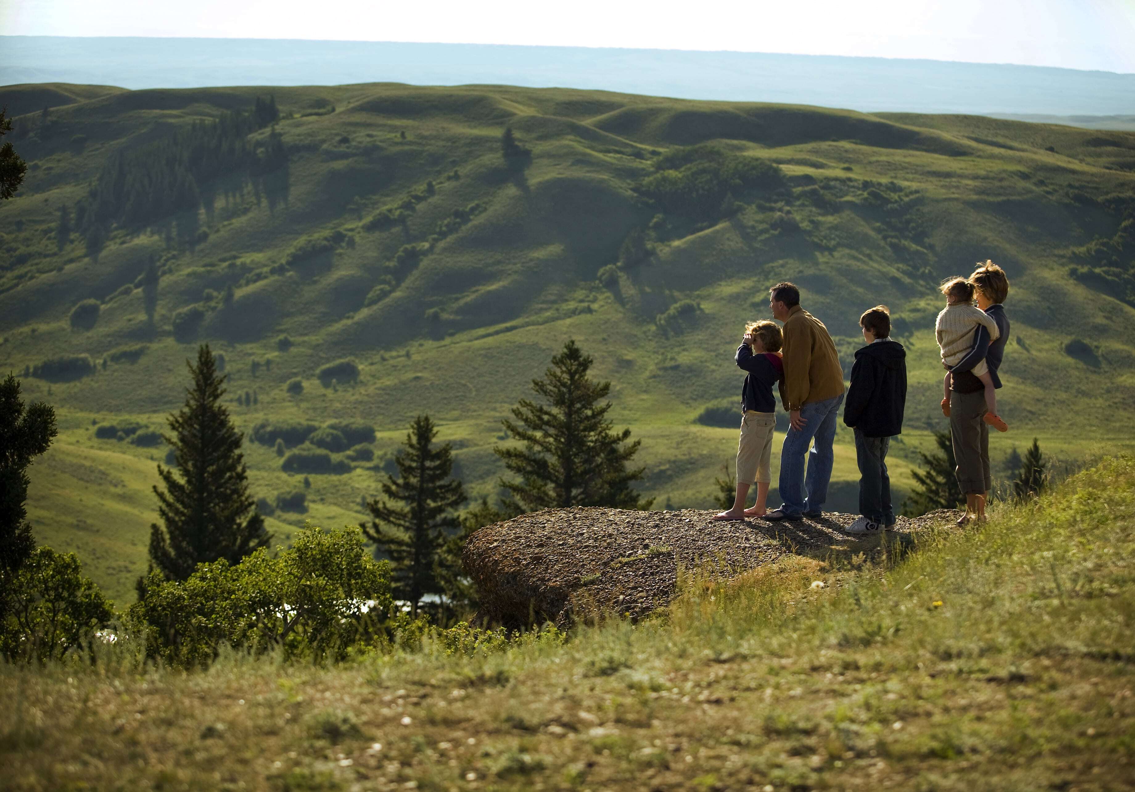
Jones’ Peak
Located near 14 km west of Eastend, Saskatchewan, Jones’ Peak offers stunning views of the valley and rangelands below. The location was named after a local amateur paleontologist, Harold “Corky” Jones who found numerous fossils in the area, including a Triceratops skull!
No camping. No Fireworks. No Loitering.
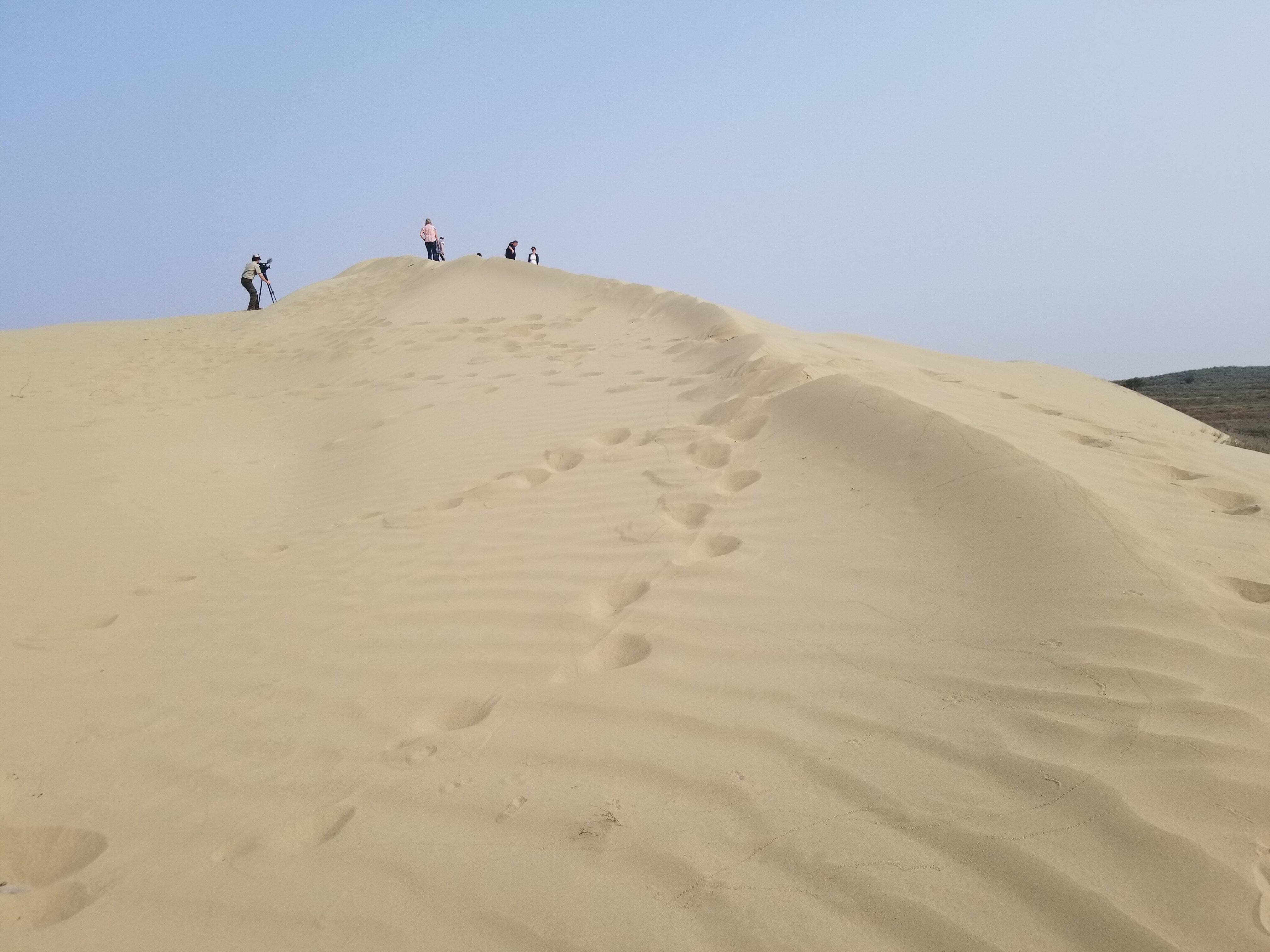
The Great Sandhills
We can thank glaciers for the huge set of sand dunes right here in Southwest Saskatchewan. The Great Sandhills are located south of Sceptre, Sk and include 1900 squared kilometres of active dunes. Repeat visits are a must, as the weather is always creating new patterns. There is a large set at the parking lot, but if you stand at the boots and look west, you’ll see another set that is worth hiking to. Dark sky photographers get amazing shots at night, just be careful not to get lost.
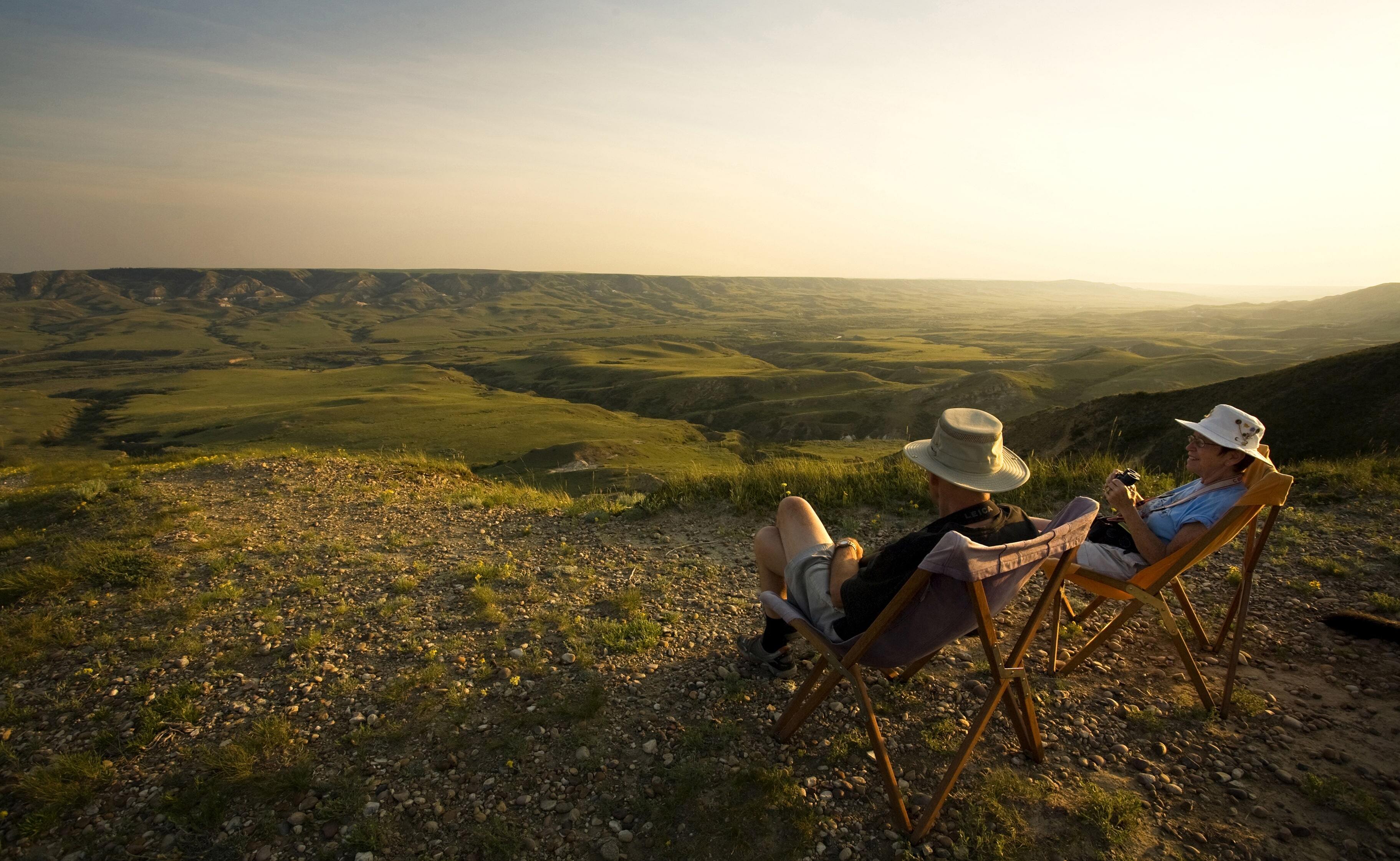
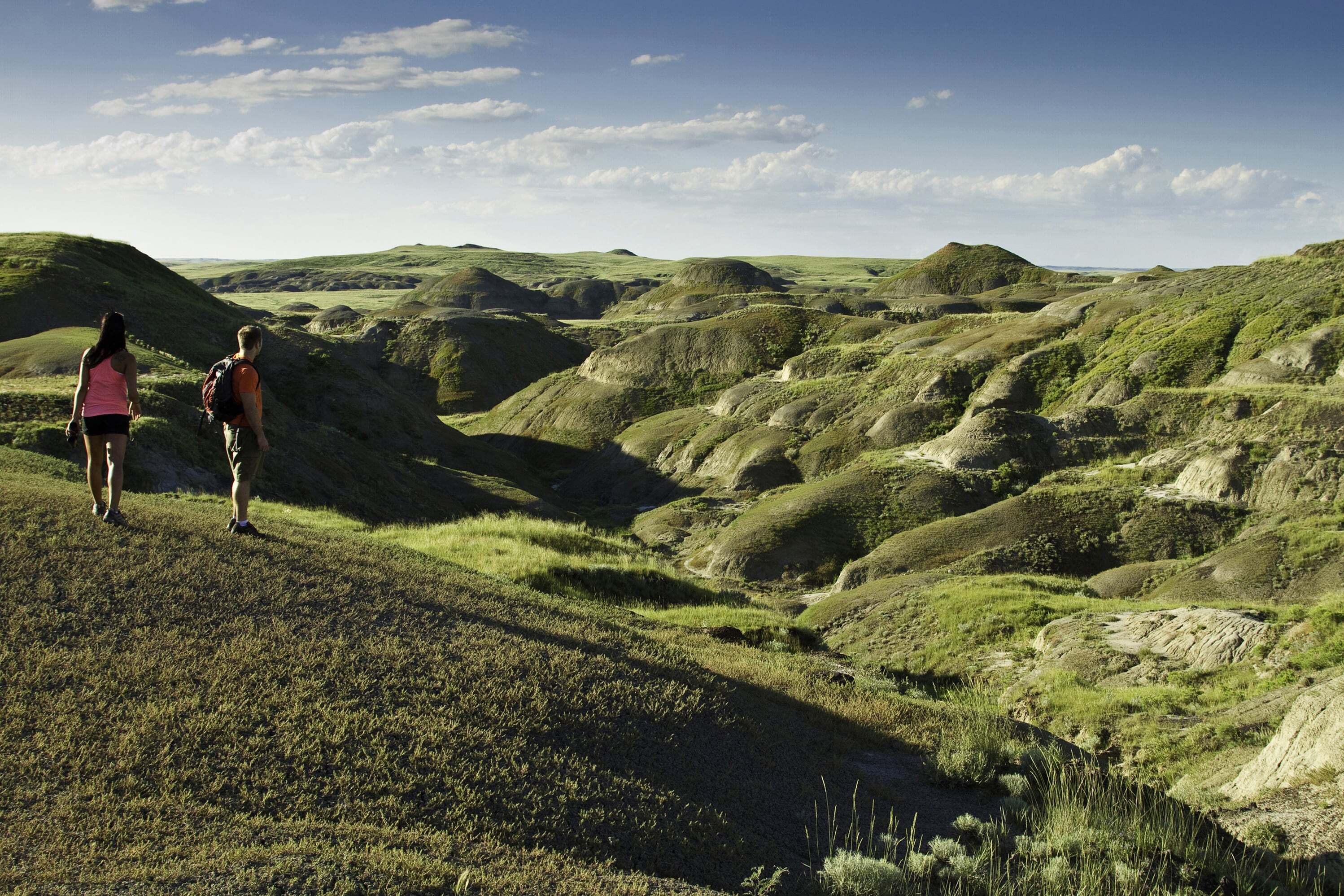
The Valley of 1000 Devils
You can drive the Badlands Parkway in the east block to get a hint of what the Valley of 1000 Devils looks like, but the 6km trek to the actual valley is the best way to experience the unusual formations. Shaped by glacial meltwater, followed by erosion from wind and water, these layered buttes jut out creating an out of this world scene. There is no shade and the heat can get very dangerous, so plan your timing and water supply accordingly!
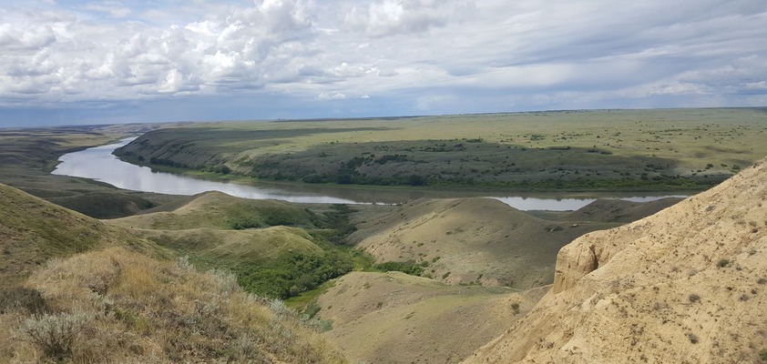
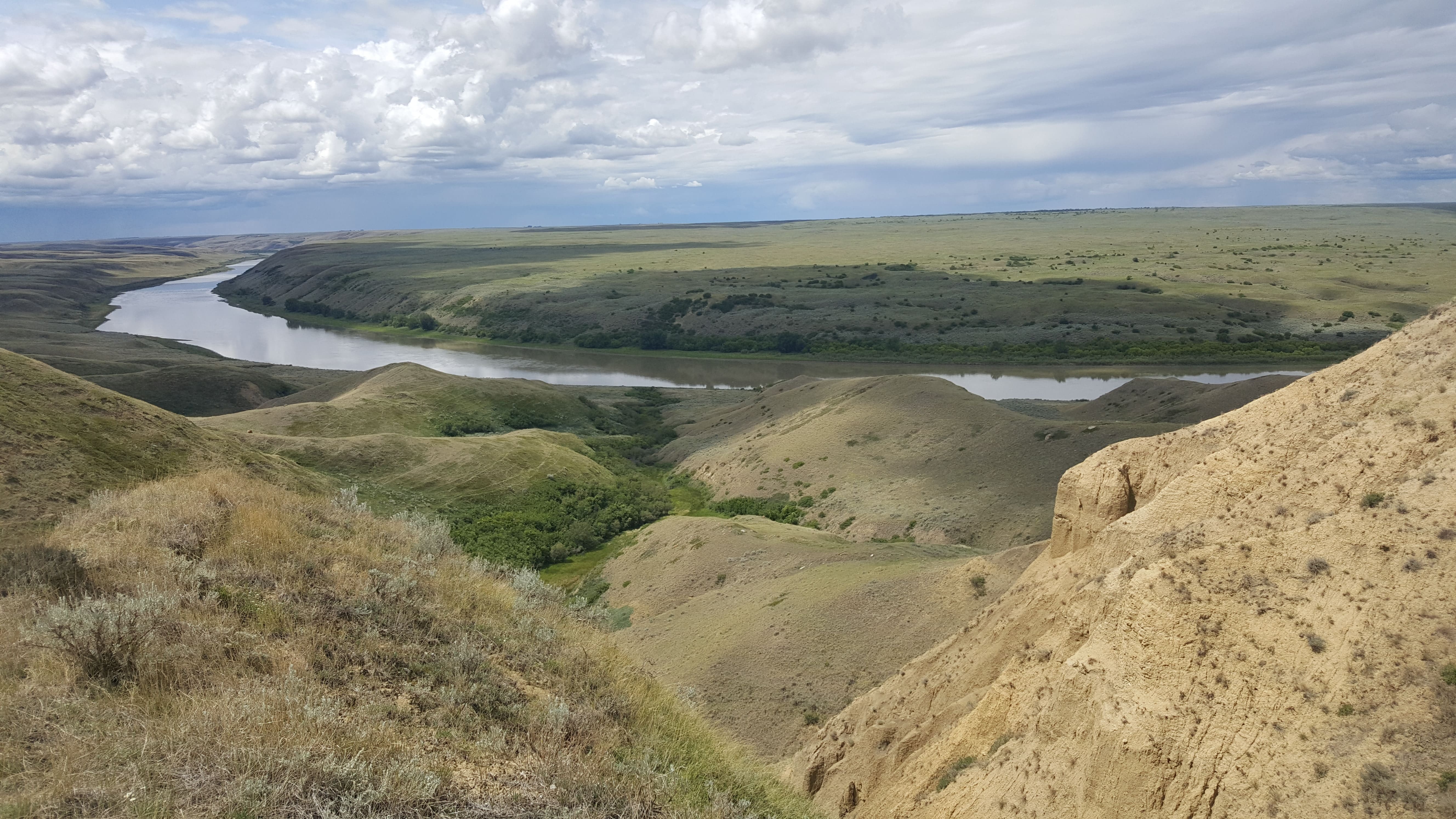
Proposed Meridian Dam Site
The South Saskatchewan River borders the northern portion of our destination area. While Checkerboard Hill, a well marked viewing point, offers a beautiful view and interpretive signs to share the history, this lesser know location offers a little more rugged look. Located approximately 30km west of Leader, this site was once the subject of debate as to whether or not a dam should be build, hence the name.
These are just five of the scenic viewpoints that you can find in the Cypress Hills - Grasslands Destinatin Area. Have you been to any of these? What locations would you add to this list?
Bringing you quality tourism experiences
Cypress Hills Interprovincial Park is a unique and ruggedly beautiful area, with forests, fields, and streams to enjoy activities like camping, hiking, fly fishing, or just relax.
The park is also a Dark-Sky Preserve – one of the largest in North America making it the best place for watching the night sky.